Klamath, California | |
|---|---|
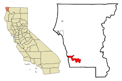
 Location in Del Norte County and the state of California | |
| Coordinates: 41°31′35″N 124°02′18″W / 41.52639°N 124.03833°W | |
| Country | United States |
| State | California |
| County | Del Norte |
| Area | |
| • Total | 12.541 sq mi (32.480 km2) |
| • Land | 12.541 sq mi (32.480 km2) |
| • Water | 0 sq mi (0 km2) 0% |
| Elevation | 30 ft (9 m) |
| Population (2020) | |
| • Total | 1,088 |
| • Density | 87/sq mi (33/km2) |
| Time zone | UTC-8 (Pacific (PST)) |
| • Summer (DST) | UTC-7 (PDT) |
| ZIP code | 95548 |
| Area code | 707 |
| FIPS code | 06-38702 |
| GNIS feature ID | 0277534 |
| U.S. Geological Survey Geographic Names Information System: Klamath, California | |
Klamath (Tolowa: Taa-chit)[2] is an unincorporated community in Del Norte County, California, situated on US Route 101 inland from the mouth of the Klamath River. The population of Klamath is 632 based on US Census estimates, down from 779 recorded in the 2010 US census. For statistical purposes, the United States Census Bureau has defined Klamath as a census-designated place (CDP). Klamath is at an elevation of 30 feet (9.1 m). Klamath is located within the Yurok Indian Reservation.
The original town center was destroyed by the 1964 Flood. Streets and sidewalks of this original site, west of US 101 and the current site of the town's core, remain visible.
- ^ "2010 Census U.S. Gazetteer Files – Places – California". United States Census Bureau.
- ^ "Siletz Talking Dictionary". Retrieved June 4, 2012.
