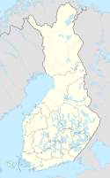
Klaukkala
Klövskog | |
|---|---|
Urban area | |
 Aerial view of Klaukkala in 2019. | |
| Coordinates: 60°22.92′N 24°44.95′E / 60.38200°N 24.74917°E | |
| Country | Finland |
| Region | Uusimaa |
| Municipality | Nurmijärvi |
| Area | |
| • Total | 44.03 km2 (17.00 sq mi) |
| Population (2020-12-31) | |
| • Total | 21,019[1] |
| • Density | 4,774/km2 (12,360/sq mi) |
| Time zone | UTC+2 (EET) |
| • Summer (DST) | UTC+3 (EEST) |
Klaukkala (Finnish: [ˈklɑu̯kːɑlɑ]; Swedish: Klövskog [ˈklø̂ːvskuːɡ], Finland Swedish: [ˈkløːvskuːɡ]) is the southern-most urban area (Finnish: taajama) of the Nurmijärvi municipality in Uusimaa, Finland, located near Lake Valkjärvi.[2] It is the largest urban area in Nurmijärvi,[2] and despite the fact that it officially has the status of a village, it is often mistakenly thought to be a separate town due to its size and structure. In the 2010s, Klaukkala's urban area grew to be part of the larger Helsinki urban area.
Klaukkala has a population of over 20,000[1] and is the fastest-growing area of Nurmijärvi; almost half of the total population of the municipality lives in Klaukkala. Its population began to rise in the 1960s,[3] when it surpassed the church village of Nurmijärvi. In the 1970s, Klaukkala also grew larger than Rajamäki, which until then was the largest of Nurmijärvi's villages.[4] At that time, Klaukkala's population was over 2,500.[5] Klaukkala has significant migration mainly from the Helsinki conurbation; being a rural village a half-hour's drive away from the Helsinki centre, it especially attracts families with children. Unfortunately, due to the enormous population growth, the village is also infamous for its growing traffic, which causes local problems at the mornings and afternoons.[6]
In the early 2000s, many detached houses were built in Klaukkala,[2] but the situation has changed as up to three-quarters of the new houses are apartment, terraced and semi-detached houses.
- ^ a b "Taajamat väkiluvun ja väestöntiheyden mukaan, 2020" (in Finnish). Statistics Finland. Archived from the original on June 22, 2022. Retrieved June 22, 2022.
- ^ a b c "Nurmijärven matkailu- ja ulkoilukartta" (PDF). Nurmijärven kunta. 2009. Archived from the original (PDF) on May 11, 2020. Retrieved November 28, 2019.
- ^ Cite error: The named reference
Klaukkala roadwas invoked but never defined (see the help page). - ^ "Nurmijärven historia" (in Finnish). Nurmijärven kunta. Retrieved August 2, 2019.
- ^ "Official statistics of Finland – Population census 1970, Volume IV" (PDF). Central Statistical Office of Finland. 1976. Retrieved October 20, 2019.
- ^ Huhta, Matti (March 14, 2012). "Klaukkalan aamuruuhkassa surffailu vie aikaa" (in Finnish). Helsingin Sanomat. Retrieved November 7, 2019.
