You can help expand this article with text translated from the corresponding article in German. (December 2009) Click [show] for important translation instructions.
|
Kleinmachnow | |
|---|---|
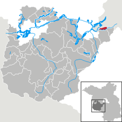
Location of Kleinmachnow within Potsdam-Mittelmark district  | |
| Coordinates: 52°24′13″N 13°13′13″E / 52.40361°N 13.22028°E | |
| Country | Germany |
| State | Brandenburg |
| District | Potsdam-Mittelmark |
| Subdivisions | 2 Ortsteile |
| Government | |
| • Mayor (2016–24) | Michael Grubert[1] (SPD) |
| Area | |
• Total | 11.94 km2 (4.61 sq mi) |
| Elevation | 42 m (138 ft) |
| Population (2022-12-31)[2] | |
• Total | 20,341 |
| • Density | 1,700/km2 (4,400/sq mi) |
| Time zone | UTC+01:00 (CET) |
| • Summer (DST) | UTC+02:00 (CEST) |
| Postal codes | 14532 |
| Dialling codes | 033203 |
| Vehicle registration | PM |
| Website | www.kleinmachnow.de |
Kleinmachnow is a municipality of about 20,000 inhabitants in the Potsdam-Mittelmark district, in Brandenburg, Germany. It is situated south-west of the borough of Steglitz-Zehlendorf and east of Potsdam.
First mentioned in the Landbuch of Karl IV in 1375, the Kleinmachnow played an important role at the Bäke beek / creek crossing, secured by multiple medieval castles. The last of these castles (none of which are preserved today) belonged to the Knights of Hake, a family who shaped the local history until the 20th century. The replacement of the Bäke (beek / creek) with the Teltow Canal in 1906 brought the village the now listed historic Kleinmachnow flood-gate.
In the first half of the 20th century, Kleinmachnow grew from a rural village to a suburban municipality of the Berlin metropolitan area. The construction of the Berlin Wall cut Kleinmachnow off from West Berlin. The community's location near the border meant it was relatively isolated in the GDR. Since the German reunification, Kleinmachnow has been part of the growth of the countryside areas outside of Berlin.
- ^ Landkreis Potsdam-Mittelmark Wahl der Bürgermeisterin / des Bürgermeisters, accessed 2 July 2021.
- ^ "Bevölkerungsentwicklung und Bevölkerungsstandim Land Brandenburg Dezember 2022" (PDF). Amt für Statistik Berlin-Brandenburg (in German). June 2023.


