Koilwar
कोइलवर | |
|---|---|
town | |
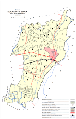
 Map of Koilwar block | |
| Coordinates: 25°34′40″N 84°47′40″E / 25.57778°N 84.79444°E | |
| Country | |
| State | Bihar |
| District | Bhojpur |
| Area | |
• Total | 5.6 km2 (2.2 sq mi) |
| Population (2011)[1] | |
• Total | 17,725 |
| • Density | 3,200/km2 (8,200/sq mi) |
| Languages | |
| • Official | Bhojpuri, Hindi |
| Time zone | UTC+5:30 (IST) |
| ISO 3166 code | IN-BR |
| Website | bhojpur |
Koilwar or Koelwar (Hindi: कोइलवर) is a nagar panchayat (town) and one of the 14 community development block in Bhojpur district in the Indian state of Bihar. As of 2011, the population of Koilwar town was 17,725, in 2,893 households.[1] Koilwar lies on the Arrah-Patna highway (NH-922).
- ^ a b c "Census of India 2011: Bihar District Census Handbook - Bhojpur, Part A (Village and Town Directory)". Census 2011 India. pp. 46, 63, 81–83, 90, 92, 348–379, 753, 808–23. Retrieved 25 October 2020.

