Kōloa, Hawaii | |
|---|---|
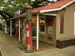
 A shop in Kōloa | |
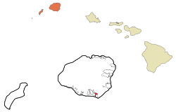
 Location in Kauai County and the state of Hawaii | |
| Coordinates: 21°54′26″N 159°27′57″W / 21.90722°N 159.46583°W | |
| Country | United States |
| State | Hawaii |
| County | Kauai |
| Area | |
| • Total | 1.25 sq mi (3.24 km2) |
| • Land | 1.25 sq mi (3.24 km2) |
| • Water | 0.00 sq mi (0.00 km2) |
| Elevation | 213 ft (65 m) |
| Population (2020) | |
| • Total | 2,231 |
| • Density | 1,781.95/sq mi (688.26/km2) |
| Time zone | UTC-10 (Hawaii-Aleutian) |
| ZIP code | 96756 |
| Area code | 808 |
| FIPS code | 15-39200 |
| GNIS feature ID | 0361395 |
Kōloa is an unincorporated community and census-designated place (CDP) in Kauaʻi County, Hawaiʻi, United States. The population was 2,231 at the 2020 census,[2] up from 1,942 at the 2000 census. The first successful sugarcane plantation in the Hawaiian Islands was started here in 1835. It became a part of Grove Farm in 1948.
Kōloa means "a long cane with a crook."[3][4] The "native duck" is the correct translation for the similar-looking koloa (without the macron).[5] According to one account, the district of Kōloa was named for a steep rock called Pali-o-kō-loa which was found in Waikomo Stream.
- ^ "2020 U.S. Gazetteer Files". United States Census Bureau. Retrieved December 18, 2021.
- ^ "Geographic Identifiers: 2010 Demographic Profile Data (G001): Koloa CDP, Hawaii". American Factfinder. U.S. Census Bureau. Retrieved February 4, 2019.[dead link]
- ^ Mary Kawena Pukui and Elbert (1986). "Hawaiian Dictionary Hawaiian-English English-Hawaiian" (PDF). Ulukau, the Hawaiian Electronic Library, University of Hawaii".
- ^ Mary Kawena Pukui and Elbert (2004). "lookup of Kōloa". on Place Names of Hawai'i. Ulukau, the Hawaiian Electronic Library, University of Hawaii. Archived from the original on May 26, 2024. Retrieved September 7, 2010.
- ^ Mary Kawena Pukui and Elbert (2003). "lookup of koloa". on Hawaiian dictionary. Ulukau, the Hawaiian Electronic Library, University of Hawaii. Retrieved August 25, 2010.