Kon Tum | |
|---|---|
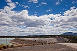
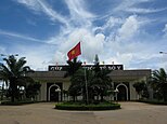
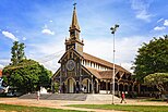
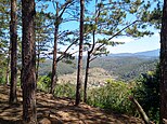
Rông House Kon Klor • Dams Yaly • Stream Đắk Glei • Mountain Đắk Glei • The border mark of the tripoint between Vietnam - Laos - Cambodia • Bố Y Border Gate • Kon Tum wooden church • Bishop of Kon Tum Building • Hotel Đồi Thông • Mountain Măng Đen • River Đắk Bla | |
 Location of Kon Tum within Vietnam | |
 | |
| Coordinates: 14°45′N 107°55′E / 14.750°N 107.917°E | |
| Country | |
| Region | Central Highlands |
| Capital | Kon Tum |
| Area | |
• Total | 9,677.30 km2 (3,736.43 sq mi) |
| Population (2023) | |
• Total | 691,300 |
| • Density | 71/km2 (190/sq mi) |
| Demographics | |
| • Ethnicities | Vietnamese, Xơ Đăng, Ba Na, Giẻ Triêng, Jarai |
| GDP[2] | |
| • Province | VND 20.057 trillion US$ 0.871 billion |
| Time zone | UTC+7 (ICT) |
| Calling code | 60 |
| ISO 3166 code | VN-28 |
| HDI (2020) | (59th) |
| Website | www |
Kon Tum is the northernmost mountainous province in the Central Highlands region, the Central of Vietnam. It borders Quảng Nam to the north, Gia Lai to the south, Quảng Ngãi to the east, Sekong, Attapeu of Laos and Ratanakiri of Cambodia in the west.
Kon Tum shares borders with Laos and Cambodia. It has an area of 9,677.30 km2 (3,736.43 sq mi)[1] and a population of approximately 530,000. The economy is primarily agricultural.
- ^ a b Biểu số 4.4: Hiện trạng sử dụng đất vùng Tây Nguyên năm 2022 [Table 4.4: Current land use status in the Central Highlands in 2022] (PDF) (Decision 3048/QĐ-BTNMT) (in Vietnamese). Ministry of Natural Resources and Environment (Vietnam). 18 October 2023. – the data in the report are in hectares, rounded to integers
- ^ "Tình hình kinh tế, xã hội Kon Tum năm 2018". Cục Thống kê tỉnh Kon Tum. Retrieved 10 May 2020.
- ^ "Human Development Index by province(*) by Cities, provincies and Year". General Statistics Office of Vietnam. Retrieved September 28, 2024.


