| Konda Конда | |
|---|---|
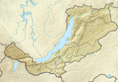
Mouth location in Buryatia, Russia | |
| Location | |
| Country | Russia |
| Federal subject | Buryatia |
| Physical characteristics | |
| Source | Yablonoi Mountains South Siberian System |
| • coordinates | 52°15′46″N 112°12′07″E / 52.26278°N 112.20194°E |
| Mouth | Vitim |
• coordinates | 53°29′44″N 113°32′16″E / 53.49556°N 113.53778°E |
• elevation | 802 m (2,631 ft) |
| Length | 285 km (177 mi) |
| Basin size | 10,400 km2 (4,000 sq mi) |
| Discharge | |
| • average | 23 m3/s (810 cu ft/s) |
| Basin features | |
| Progression | Vitim→ Lena→ Laptev Sea |
The Konda (Russian: Конда) is a river in Buryatia, southern East Siberia, Russia. It is 285 kilometres (177 mi) long, and has a drainage basin of 10,400 square kilometres (4,000 sq mi).[1] There are a few inhabited places close to the banks of the river, including Tselinny, Konda, Telemba and Alekseevka in the Yeravninsky District.[2][3]
The Konda is a river rich in fish. Tourists regularly visit the area for fishing and watersports.[2] There is a military training ground of the Russian Armed Forces Eastern Military District 1 km (0.62 mi) to the west of the left bank of the river in the area of Telemba village.[4][5]
- ^ "Река Конда in the State Water Register of Russia". textual.ru (in Russian).
- ^ a b Cite error: The named reference
WRwas invoked but never defined (see the help page). - ^ Google Earth
- ^ Russia to expand Telemba military range
- ^ Энциклопедия Забайкалья - Телембинский острог
