| Kopachuck State Park | |
|---|---|
 | |
| Location | Pierce, Washington, United States |
| Coordinates | 47°18′59″N 122°40′42″W / 47.31639°N 122.67833°W[1] |
| Area | 109 acres (44 ha) |
| Elevation | 52 ft (16 m)[1] |
| Established | Unspecified |
| Operator | Washington State Parks and Recreation Commission |
| Website | Kopachuck State Park |
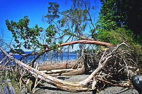
Kopachuck State Park is a publicly owned recreation area situated on Henderson Bay in Puget Sound, about 6 miles (9.7 km) west of the city of Gig Harbor, Washington. The state park's 109 acres (44 ha) encompass over a mile of saltwater shoreline. The park provides sweeping views of sunsets, the Olympic Mountains and Puget Sound.[2] Cutts Island, known locally as "Deadman's Island," which lies about a half-mile from the park shore, is reachable by boat.[3] Both Kopachuck and Cutts Island are administered by the Washington State Parks and Recreation Commission.
- ^ a b "Kopachuck State Park". Geographic Names Information System. United States Geological Survey, United States Department of the Interior.
- ^ Cite error: The named reference
waspwas invoked but never defined (see the help page). - ^ Cite error: The named reference
wasp2was invoked but never defined (see the help page).

