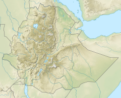
| Korowya | |
|---|---|
 The Korowya River at Addi Kawa | |
Korowya River in Kola Tembien | |
| Etymology | Named after the homonymous village |
| Location | |
| Country | Ethiopia |
| Region | Tigray Region |
| District (woreda) | Kola Tembien |
| Physical characteristics | |
| Source | Slopes of Tsili |
| • location | Haddinnet municipality |
| • elevation | 1,908 m (6,260 ft) |
| Mouth | Tsaliet River |
• location | 3.5 km north of Addeha |
• coordinates | 13°27′57″N 39°06′04″E / 13.4657°N 39.1011°E |
• elevation | 1,643 m (5,390 ft) |
| Length | 12 km (7.5 mi) |
| Width | |
| • average | 50 m (160 ft) |
| Basin features | |
| Progression | Tsaliet→ Wari→ Tekezé→ Atbarah→ Nile→ Mediterranean Sea |
| River system | Permanent river (low baseflow) |
| Landmarks | Mt. Itay Sarah, Mika’el Samba and Maryam Hibeto rock churches |
| Bridges | N of Addeha, on the road to Hawzien |
| Topography | Pediment surrounded by steep sandstone mountains |
The Korowya is a river of the Nile basin. Rising in the mountains of Dogu’a Tembien in northern Ethiopia, it flows westward to empty finally in the Weri’i and Tekezé River.

