| Kowen Australian Capital Territory | |||||||||||||||
|---|---|---|---|---|---|---|---|---|---|---|---|---|---|---|---|
 | |||||||||||||||
| Coordinates | 35°18′39″S 149°18′49″E / 35.31078°S 149.31367°E | ||||||||||||||
| Population | 38 (2016 census)[1] | ||||||||||||||
| • Density | 0.494/km2 (1.278/sq mi) | ||||||||||||||
| Postcode(s) | 2609 | ||||||||||||||
| Area | 77.0 km2 (29.7 sq mi) | ||||||||||||||
| Territory electorate(s) | Kurrajong | ||||||||||||||
| Federal division(s) | Fenner | ||||||||||||||
| |||||||||||||||
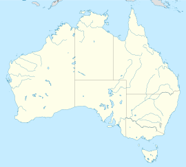
Kowen is a district in the Australian Capital Territory in Australia.[2] It is situated in the northeast corner of the ACT, to the east of Sutton Road and the town of Queanbeyan, New South Wales. Kowen is primarily covered by pine forests, and is also used for farming. The main highway between the ACT and the south coast region, the Kings Highway, runs directly through the Kowen.
The 1966 Act describes the Kowen District as being:
- All that part of the Australian Capital Territory commencing at the intersection of the middle thread of Sutton Road with the generally northeastern boundary of the Territory; and bounded thence by generally northeastern, eastern and southern boundaries of the Territory generally southeasterly, southerly and westerly, respectively, to the middle thread of Sutton Road; thence by part of the middle thread of Sutton Road generally northeasterly to the point of commencement.
The area is well known to mountain bikers as the site of the Sparrow Hill mountain biking area, an eastern enclave of Kowen Forest. A new 5 km alignment of the Kings Highway was constructed in 2010–11 to improve the safety of the road. The new section divides Sparrow Hill into two parts, and includes overtaking lanes in both directions, and bypasses a dangerous, winding section of road, including at least six bends.[3]
- ^ Australian Bureau of Statistics (27 June 2017). "Kowen (SA 2)". 2016 Census QuickStats. Retrieved 1 July 2017.
- ^ Australian Capital Territory Districts Act 1966 (repealed). Retrieved 28 May 11
- ^ http://sparrowhill.info
