Kraljevo
Краљево (Serbian) | |
|---|---|
| City of Kraljevo | |
|
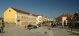
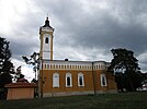
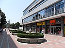
From top: National Museum of Kraljevo, The church of the Holy Trinity, Main pedestrian street, Maglič Fortress, Morava Airport, Žiča Monastery, Archive in Kraljevo | |
 Location of the city of Kraljevo within Serbia | |
| Coordinates: 43°43′25″N 20°41′15″E / 43.72361°N 20.68750°E | |
| Country | |
| Region | Šumadija and Western Serbia |
| District | Raška |
| Settlements | 92 |
| Government | |
| • Mayor | Predrag Terzić[1] (SNS) |
| Area | |
| • Rank | 2nd in Serbia |
| • Urban | 24.43 km2 (9.43 sq mi) |
| • Administrative | 1,529.55 km2 (590.56 sq mi) |
| Elevation | 192 m (630 ft) |
| Population (2022 census)[3] | |
| • Rank | 9th in Serbia |
| • Urban | 61,490 |
| • Urban density | 2,500/km2 (6,500/sq mi) |
| • Administrative | 110,196 |
| • Administrative density | 72/km2 (190/sq mi) |
| Time zone | UTC+1 (CET) |
| • Summer (DST) | UTC+2 (CEST) |
| Postal code | 36000 |
| Area code | +381(0)36 |
| ISO 3166 code | SRB |
| Car plates | KV |
| Website | www |
Kraljevo (Serbian Cyrillic: Краљево, pronounced [krǎːʎɛʋɔ] ) is a city and the administrative center of the Raška District in central Serbia. It is situated on the confluence of West Morava and Ibar, in the geographical region of Šumadija, between the mountains of Kotlenik in the north, and Stolovi in the south.
In 2022 the city urban area has a population of 61,490 inhabitants, while the city administrative area has 110,196 inhabitants. With an area of 1530 km2, it is the largest municipality (after Belgrade) in Serbia by area.
- ^ "Novi gradonačelnik Kraljeva Tomislav Ilić iz Nove Srbije". Blic (in Serbian). 20 June 2014. Archived from the original on 24 September 2015. Retrieved 12 April 2015.
- ^ "Municipalities of Serbia, 2006". Statistical Office of Serbia. Retrieved 2010-11-28.
- ^ "2022 Census of Population, Households and Dwellings: Ethnicity (data by municipalities and cities)" (PDF). Statistical Office of Republic Of Serbia, Belgrade. April 2023. ISBN 978-86-6161-228-2. Retrieved 2023-04-30.


