| Kundala Dam | |
|---|---|
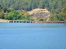
 View of Kundala dam and reservoir | |
| Official name | Setuparvatipuram Dam |
| Country | India |
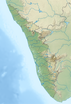
| Location | Idukki, Kerala |
| Coordinates | 10°08′37″N 77°11′15″E / 10.14361°N 77.18750°E |
| Purpose | Power |
| Status | Operational |
| Opening date | 1947 |
| Owner(s) | Kerala State Electricity Board |
| Dam and spillways | |
| Type of dam | Gravity dam |
| Impounds | Muthirapuzha River |
| Height (foundation) | 36.94 m (121.2 ft) |
| Length | 259.38 m (851.0 ft) |
| Elevation at crest | 1,756.86 m (5,764.0 ft) |
| Spillways | 5 |
| Spillway type | Ogee type |
| Spillway capacity | 183.95 m3/s (6,496 cu ft/s) |
| Reservoir | |
| Creates | Kundala Reservoir |
| Total capacity | 77,900,000 m3 (2.75×10⁹ cu ft) |
| Active capacity | 76,500,000 m3 (2.70×10⁹ cu ft) |
| Surface area | 0.0047 km2 (0.0018 sq mi) |
| Maximum water depth | 1,759.3 m (5,772 ft) |
| Normal elevation | 1,758.69 m (5,770.0 ft) |
| Pallivasal Power Station | |
| Coordinates | 10°01′53″N 77°03′17″E / 10.03139°N 77.05472°E |
| Operator(s) | Kerala State Electricity Board |
| Commission date | March 19, 1940 |
| Turbines | 3 × 5 MW & 3 × 7.5 MW (Pelton-type) |
| Installed capacity | 37.50 MW |
| Annual generation | 284 MU |
| Website Official website | |
Kundala Dam (Malayalam: കുണ്ടള അണക്കെട്ട്), also known as Setuparvatipuram Dam, is a masonry gravity dam built on Muthirapuzha River in Mattupetty panchayat of Idukki district in Kerala, India.[1] It is part of the Pallivasal Hydroelectric Project, the first hydroelectric project in Kerala.[2] The dam is considered to be Asia's first arch dam.[3] It has a height of 46.93 m (154.0 ft) and length of 259.38 m (851.0 ft).[2] Release from dam is to river Palar and taluks through which release flow are Udumbanchola, Devikulam, Kothamangalam, Muvattupuzha, Kunnathunadu, Aluva, Kodungalloor and Paravur.[1]
- ^ a b "Kundala Dam – KSEB Limited Dam Safety Organisation". Retrieved 2023-07-10.
- ^ a b "Kerala State Electricity Board Limited - Kerala State Electricity Board Limited". www.kseb.in. Retrieved 2023-07-10.
- ^ "Kundala Dam - Trout Lagoon Boating Centre Kundala - Munnar". www.keralahydeltourism.com. Retrieved 2023-07-10.

