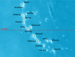
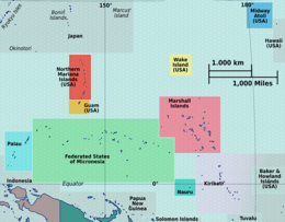
 Map of Kuria | |
 | |
| Geography | |
|---|---|
| Location | Pacific Ocean |
| Coordinates | 0°13′43″N 173°24′38″E / 0.22861°N 173.41056°E |
| Archipelago | Gilbert Islands |
| Area | 15.48 km2 (5.98 sq mi) |
| Highest elevation | 3 m (10 ft) |
| Administration | |
| Demographics | |
| Population | 1,046 (2015 Census) |
| Pop. density | 63/km2 (163/sq mi) |
| Ethnic groups | I-Kiribati 100% |
Kuria is an atoll, formed by a pair of islets, in the Central Gilbert Islands in Kiribati, northwest of Aranuka. The two islets, Buariki and Oneeke, are separated by a 20 metre wide channel on a shallow water platform (Te buriiti), which is crossed by a bridge of the connecting road. The islands are surrounded by fringing reef which is broadest on the eastern side of Kuria. The population of Kuria was 1,046 in 2015.[1]
- ^ "9. Kuria" (PDF). Office of Te Beretitent - Republic of Kiribati Island Report Series. 2012. Retrieved 28 April 2015.


