This article needs additional citations for verification. (August 2010) |
| Kuta | |
|---|---|
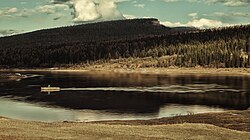
 View of the river | |
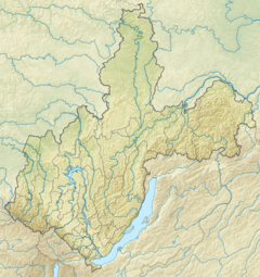
Mouth location in Irkutsk Oblast, Russia | |
| Physical characteristics | |
| Source | Lena-Angara Plateau |
| • coordinates | 57°33′17″N 105°53′42″E / 57.55472°N 105.89500°E |
| • elevation | 650 m (2,130 ft) |
| Mouth | Lena |
• location | Ust-Kut |
• coordinates | 56°45′15″N 105°39′25″E / 56.75417°N 105.65694°E |
• elevation | 284 m (932 ft) |
| Length | 408 km (254 mi) |
| Basin size | 12,500 km2 (4,800 sq mi) |
| Basin features | |
| Progression | Lena→ Laptev Sea |
| Tributaries | |
| • right | Kupa |
The Kuta is a Siberian river north of Lake Baikal in Irkutsk Oblast, Russia, that flows into the Lena at Ust-Kut. With its right tributary, the Kupa, it forms a ‘T’ shape with the flat head pointing west and the point at Ust-Kut. The river is 408 kilometres (254 mi) long and its basin is about 12,500 square kilometres (4,800 sq mi).[1]
