Kutch | |
|---|---|
| Kachchh | |
 Location of Kutch district in Gujarat | |
| Coordinates (Bhuj): 23°54′54″N 70°22′1″E / 23.91500°N 70.36694°E | |
| Country | |
| State | Gujarat |
| Headquarters | Bhuj |
| Tehsils | 10 |
| Government | |
| • Lok Sabha constituencies | Kutch |
| • Vidhan Sabha constituencies | 6 |
| Area | |
• Total | 45,674 km2 (17,635 sq mi) |
| Population (2011) | |
• Total | 2,092,371 |
| • Density | 46/km2 (120/sq mi) |
| Demographics | |
| • Literacy | 70.59 |
| • Sex ratio | 908 |
| • Language | |
| Time zone | UTC+05:30 (Indian Standard Time) |
| Vehicle registration | GJ-12 |
| Major highways | 1 |
| Website | kachchh |
| Official name | Dholavira: A Harappan City |
| Type | Cultural |
| Criteria | Cultural: (iii)(iv) |
| Designated | 2021 (44th session) |
| Reference no. | 1645 |
| Region | Southern Asia |
Kutch district, officially spelled Kachchh, is a district of Gujarat state in western India, with its headquarters (capital) at Bhuj. Covering an area of 45,674 km2,[1] it is the largest district of India. The area of Kutch is larger than the entire area of other Indian states like Haryana (44,212 km2) and Kerala (38,863 km2), as well as the country of Estonia (45,335 km2).[2] The population of Kutch is about 2,092,371.[3] It has 10 talukas, 939 villages and 6 municipalities.[3] The Kutch district is home to the Kutchi people who speak the Kutchi language.
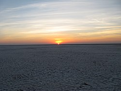
Kutch literally means something which intermittently becomes wet and dry; a large part of this district is known as Rann of Kutch which is shallow wetland which submerges in water during the rainy season and becomes dry during other seasons. The same word is also used in Sanskrit origin for a tortoise. The Rann is known for its marshy salt flats which become snow white after the shallow water dries up each season before the monsoon rains.
The district is also known for ecologically important Banni grasslands with their seasonal marshy wetlands which form the outer belt of the Rann of Kutch.
Kutch is surrounded by the Gulf of Kutch and the Arabian Sea to the south and west, while the northern and eastern parts are surrounded by the Great and Little Rann (seasonal wetlands) of Kutch. It is also next to the border with Pakistan, a neighbouring country of India. When there were not many dams built on its rivers, the Rann of Kutch remained wetlands for a large part of the year. Even today, the region remains wet for a significant part of year. The district had a population of 2,092,371 as of 2011 census, of which 30% were urban.[4] Motor vehicles registered in Kutch district have a registration number starting with GJ-12. The district is well connected by road, rail and air. There are four airports in the district: Naliya, Anjar, Mundra, and Bhuj. Bhuj and Anjar are well connected with Mumbai airport. Being a border district, Kutch has both an army and an air force base.
- ^ "Kutch" (PDF). Vibrantgujarat.com. Archived from the original (PDF) on 21 October 2012. Retrieved 17 November 2012.
- ^ Sen, Kavita (January 2001). "Economic consequences of the Gujarat earthquake". Academia. Retrieved 21 May 2021.
- ^ a b "About Kutch | About Us | Collectorate - District Kutch". Archived from the original on 27 June 2018. Retrieved 8 February 2016.
- ^ "Census GIS India". Censusindiamaps.net. Archived from the original on 11 January 2010. Retrieved 17 November 2012.


