| Kyuyutingde Кюютингдэ | |
|---|---|
 Course of the Kyuyutingde ONC map section | |
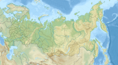
Mouth location in Yakutia, Russia | |
| Location | |
| Country | Russian Federation |
| Federal subject | Yakutia |
| District | Bulunsky District |
| Physical characteristics | |
| Source | |
| • location | Kystyk Plateau |
| Mouth | Olenyok |
• coordinates | 70°35′14.2″N 122°32′37.3″E / 70.587278°N 122.543694°E |
| Length | 138 km (86 mi) (196 km (122 mi)) |
| Basin size | 3,420 km2 (1,320 sq mi) |
| Basin features | |
| Progression | Olenyok→Laptev Sea |
The Kyuyutingde (Russian: Кюютингдэ)[1] is a river in Yakutia (Sakha Republic), Russia. It is a tributary of the Olenyok with a length of 138 kilometres (86 mi) —196 km (122 mi) including the Debengde at its head— and a drainage basin area of 3,420 square kilometres (1,320 sq mi).[2] It flows north of the Arctic Circle across a desolate area of Bulunsky District devoid of settlements and joins the Olenyok in its final major bend, where it begins to head northwards until the Laptev Sea.[3]
The river gives its name to the Kyuyutingde Formation, a dolomite geological formation in the Olenyok Uplift.[4]

