L'Anse Township, Michigan | |
|---|---|
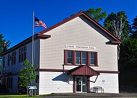
 L'Anse Township Hall in the village of L'Anse | |
 | |
| Coordinates: 46°43′41″N 88°22′18″W / 46.72806°N 88.37167°W | |
| Country | |
| State | |
| County | |
| Area | |
| • Total | 269.0 sq mi (696.8 km2) |
| • Land | 247.4 sq mi (640.8 km2) |
| • Water | 21.6 sq mi (56.0 km2) |
| Elevation | 1,365 ft (416 m) |
| Population (2020) | |
| • Total | 3,551 |
| • Density | 16/sq mi (6.0/km2) |
| Time zone | UTC-5 (Eastern (EST)) |
| • Summer (DST) | UTC-4 (EDT) |
| ZIP code | 49946 |
| Area code | 906 |
| FIPS code | 26-45560[1] |
| GNIS feature ID | 1626587[2] |
| Website | Official website |
L'Anse Township is a civil township of Baraga County in the U.S. state of Michigan. As of the 2020 census, the township population was 3,551.[3] The township contains Mount Arvon and Mount Curwood, Michigans highest and second-highest points, as well as the village of L'Anse.
- ^ "U.S. Census website". United States Census Bureau. Retrieved January 31, 2008.
- ^ "L'Anse Township, Michigan". Geographic Names Information System. United States Geological Survey, United States Department of the Interior.
- ^ "Explore Census Data". data.census.gov. Retrieved August 4, 2023.

