L'Isle-aux-Allumettes | |
|---|---|
 | |
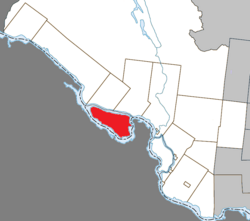
 Location within Pontiac RCM | |
| Coordinates: 45°52′N 77°04′W / 45.867°N 77.067°W[1] | |
| Country | Canada |
| Province | Quebec |
| Region | Outaouais |
| RCM | Pontiac |
| Constituted | December 30, 1998 |
| Government | |
| • Mayor | Corey Spence |
| • Federal riding | Pontiac |
| • Prov. riding | Pontiac |
| Area | |
• Total | 210.60 km2 (81.31 sq mi) |
| • Land | 185.94 km2 (71.79 sq mi) |
| Population (2021)[3] | |
• Total | 1,382 |
| • Density | 7.4/km2 (19/sq mi) |
| • Pop (2016-21) | |
| • Dwellings | 1,124 |
| Time zone | UTC−5 (EST) |
| • Summer (DST) | UTC−4 (EDT) |
| Postal code(s) | |
| Area code | 819 |
| Highways | |
| Website | www |
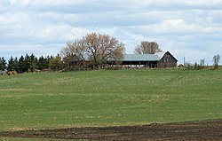
L'Isle-aux-Allumettes is a municipality in the Outaouais region, part of the Pontiac Regional County Municipality, Quebec, Canada. The municipality consists primarily of Allumette Island (in French Île aux Allumettes), and also includes Morrison Island, Marcotte Island, and some minor islets, all in the Ottawa River north of Pembroke.
In the past, the island and municipalities have been spelled in French in various ways:[4]
- Isle-des-Allumettes
- L'Île-Allumettes
- Île-aux-Allumettes
- ^ Cite error: The named reference
toponymiewas invoked but never defined (see the help page). - ^ a b "L'Isle-aux-Allumettes". Répertoire des municipalités (in French). Ministère des Affaires municipales et de l'Habitation. Retrieved 25 October 2022.
- ^ a b "L'Isle-aux-Allumettes, Municipalité (MÉ) Census Profile, 2021 Census of Population". www12.statcan.gc.ca. Government of Canada - Statistics Canada. Retrieved 25 October 2022.
- ^ "Municipalité de canton L'Isle-aux-Allumettes" (in French). Commission de toponymie du Québec. Retrieved 2008-04-14.
