| La Honda Creek Arroyo Hondo[1] | |
|---|---|
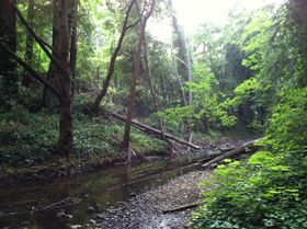
 La Honda Creek flows through Play Bowl in La Honda, California | |
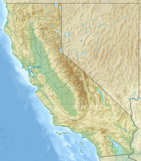
Location of the mouth of La Honda Creek at its confluence with Alpine Creek | |
| Location | |
| Country | United States |
| State | California |
| Region | San Mateo County |
| Physical characteristics | |
| Source | Western slope of the Santa Cruz Mountains |
| • location | near Allen Lookout, San Mateo County, California |
| Source confluence | |
| • location | La Honda, California, San Mateo County, United States of America |
| • coordinates | 37°19′45″N 122°16′58″W / 37.32917°N 122.28278°W |
| • elevation | 320 ft (98 m) |
| Mouth | Pacific Ocean |
• location | San Gregorio, California |
• coordinates | 37°18′36″N 122°16′37″W / 37.31000°N 122.27694°W[2] |
• elevation | 0 ft (0 m) |
| Basin features | |
| Tributaries | |
| • left | Alpine Creek |
| • right | La Honda Creek, Harrington Creek, Bogess Creek, El Corte de Madera Creek, Clear Creek, Coyote Creek |
La Honda Creek is a 7 miles (11 km) long stream on the Pacific slope of the Santa Cruz Mountains and is a tributary of San Gregorio Creek.[3] From its source (37°23′32″N 122°17′30″W / 37.3923°N 122.2918°W) near Bear Gulch Road and Skyline Boulevard (CA 35) in San Mateo County, California, La Honda Creek's water flow south to its confluence with Alpine Creek to form San Gregorio Creek in La Honda, and thence to the Pacific Ocean.
- ^ Hoover, Mildred B. (1966). Historic Spots in California, 3rd edition. Stanford, California: Stanford University Press.
- ^ U.S. Geological Survey Geographic Names Information System: San Gregorio Creek
- ^ U.S. Geological Survey. National Hydrography Dataset high-resolution flowline data. The National Map, accessed March 10, 2011
