La Matanza de Acentejo | |
|---|---|
 Municipal location in Tenerife | |
| Coordinates: 28°27′10″N 16°27′20″W / 28.45278°N 16.45556°W | |
| Country | |
| Autonomous community | |
| Province | |
| Island | |
| Area | |
• Total | 14.11 km2 (5.45 sq mi) |
| Elevation | 425 m (1,394 ft) |
| Population (2018)[2] | |
• Total | 8,956 |
| • Density | 630/km2 (1,600/sq mi) |
| Climate | Csb |
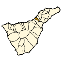
La Matanza de Acentejo is a town near the north coast of Tenerife, Canary Islands, Spain. It is located 10 km east of Puerto de la Cruz, and about 20 km west of the island's capital, Santa Cruz de Tenerife. Its name means "the Slaughter of Acentejo" in Spanish, and refers to the 1494 First Battle of Acentejo, lost by the Spanish.
The population is 8,944 (2013)[3] and the area is 14.11 km2. The elevation is 425 m. The TF-5 motorway passes through the municipality. The municipality contains the following settlements:[3]
- La Matanza de Acentejo
- Guia
- Las Breñas
- El Caleton
- Acentejo
- San Antonio
- San Cristobal
- ^ a b "SUPERFICIE, PERÍMETRO Y ALTITUD DE LOS MUNICIPIOS DE CANARIAS" (in Spanish). Instituto Canario de Estadística (ISTAC). Archived from the original on 2012-12-04.
- ^ Municipal Register of Spain 2018. National Statistics Institute.
- ^ a b "Población en Canarias. Tenerife. 1-1-2013" (in Spanish). Instituto Canario de Estadística (ISTAC). Archived from the original on 2014-04-18.


