La Vernia, Texas | |
|---|---|
City | |
 | |
| Nickname(s): L V, Bear Country | |
| Motto: This is Bear Country | |
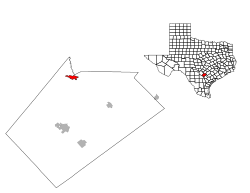
 Location of La Vernia, Texas | |
 | |
| Coordinates: 29°21′16″N 98°07′45″W / 29.35444°N 98.12917°W | |
| Country | United States |
| State | Texas |
| County | Wilson |
| Area | |
• Total | 2.39 sq mi (6.20 km2) |
| • Land | 2.39 sq mi (6.19 km2) |
| • Water | 0.00 sq mi (0.01 km2) |
| Elevation | 495 ft (151 m) |
| Population (2020) | |
• Total | 1,077 |
| • Density | 597.74/sq mi (230.77/km2) |
| Time zone | UTC−6 (Central (CST)) |
| • Summer (DST) | UTC−5 (CDT) |
| ZIP code | 78121 |
| Area code | 830 |
| FIPS code | 48-41764[3] |
| GNIS feature ID | 2411585[2] |
| Website | lavernia-tx.gov |
La Vernia is a city in Wilson County, Texas, United States. La Vernia is on the south bank of Cibolo Creek at the junction of U.S. Highway 87 and Texas Farm to Market Road 775, approximately 25 miles east of downtown San Antonio.[4] The population was 1,077 at the 2020 census.[5][6] La Vernia is part of the San Antonio Metropolitan Statistical Area.
- ^ "2019 U.S. Gazetteer Files". United States Census Bureau. Retrieved August 7, 2020.
- ^ a b U.S. Geological Survey Geographic Names Information System: La Vernia, Texas
- ^ "U.S. Census website". United States Census Bureau. Retrieved January 31, 2008.
- ^ Hazlewood, Claudia (June 15, 2010). "LA VERNIA, TX". www.tshaonline.org. La Vernia Municipal Development District. Archived from the original on March 20, 2022.
- ^ "La Vernia (Lavernia), TX Population - Census 2010 and 2000 Interactive Map, Demographics, Statistics, Quick Facts - CensusViewer". censusviewer.com. Retrieved October 24, 2016.
- ^ "Demographics". La Vernia Municipal Development District. Retrieved May 19, 2018.