Labelle | |
|---|---|
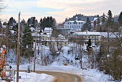
 Downtown Labelle | |
 Location within Les Laurentides RCM | |
| Coordinates: 46°17′N 74°44′W / 46.283°N 74.733°W[1] | |
| Country | Canada |
| Province | Quebec |
| Region | Laurentides |
| RCM | Les Laurentides |
| Constituted | January 27, 1973 |
| Government | |
| • Mayor | Vicki Emard |
| • Federal riding | Laurentides—Labelle |
| • Prov. riding | Labelle |
| Area | |
• Total | 216.30 km2 (83.51 sq mi) |
| • Land | 196.69 km2 (75.94 sq mi) |
| Population (2021)[3] | |
• Total | 2,765 |
| • Density | 12.3/km2 (32/sq mi) |
| • Pop 2016-2021 | |
| • Dwellings | 2,017 |
| Time zone | UTC−5 (EST) |
| • Summer (DST) | UTC−4 (EDT) |
| Postal code(s) | |
| Area code | 819 |
| Highways | |
| Website | www.municipalite .labelle.qc.ca |
Labelle (French pronunciation: [labɛl]) is a village and municipality in the Laurentides region of Quebec, Canada, part of the Les Laurentides Regional County Municipality. Its large L-shaped territory surrounds Lake Labelle, and the village is located along the Rouge River and Route 117.

