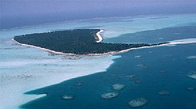
Laccadive Islands Kannur Islands | |
|---|---|
 The Laccadive subgroup on an 1800 map | |
| Country | |
| Union Territory | Lakshadweep |
| District | Lakshadweep |
| Area | |
• Total | 17.5 km2 (6.8 sq mi) |
| Languages | |
| • Official | Malayalam |
| Time zone | UTC+5:30 (IST) |
| Vehicle registration | LD |

The Laccadive /ˈlækədɪv/ or Kannur /ˈkænənɔːr/ Islands are one of the three island subgroups in the Union Territory of Lakshadweep, India. It is the central subgroup of the Lakshadweep, separated from the Amindivi Islands subgroup roughly by the 11th parallel north and from the atoll of Minicoy (Maliku)—far to the south—by the 9 Degree or Mamala Channel.[1]
Formerly the Union Territory of Lakshadweep was known as Laccadive, Minicoy, and Amindivi Islands,[2] a name that was changed to Lakshadweep by an act of Parliament in 1973.[3]
The Laccadive subgroup had been known earlier as the "Cannanore Islands"[4] after the coastal town of Kannur. The name originated in the fact that while the northern group of Amindivi had stopped in 1784 being a vassal state of the Kannur Kingdom (Arakkal) in exchange for fealty to Tippu Sultan's Kingdom of Mysore, the southern group remained loyal to Kannur.
- ^ GEBCO Gazetteer of undersea feature names
- ^ Lakshadweep | union territory, India | Britannica
- ^ "The name of the Laccadive, Minicoy and Amindivi islands". Archived from the original on 23 February 2019. Retrieved 4 December 2015.
- ^ Imperial Gazetteer of India, v. 16, p. 85.
