This article needs additional citations for verification. (December 2008) |
| Lachine Canal | |
|---|---|
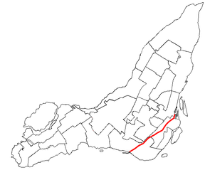
 The canal's path through Montreal's boroughs | |
 | |
| Specifications | |
| Locks | 5 (originally 7[1]) |
| Maximum height above sea level | 65 ft (20 m) |
| Navigation authority | Parks Canada |
| History | |
| Original owner | Company of the Proprietors of the Lachine Canal |
| Principal engineer | Thomas Burnett |
| Construction began | July 17, 1821 |
| Date of first use | 1825 |
| Date completed | August 24, 1824 |
| Date extended | 1843–1848, 1873–1885 |
| Date closed | 1970 |
| Date restored | 2002 |
| Geography | |
| Start point | Old Port of Montreal |
| End point | Lachine Lock |
The Lachine Canal (French: Canal de Lachine) is a canal passing through the southwestern part of the Island of Montreal, Quebec, Canada, running 14.5 kilometres (9 miles) from the Old Port of Montreal to Lake Saint-Louis, through the boroughs of Lachine, Lasalle and Sud-Ouest.
Before the canal construction there was a lake, Lac St-Pierre or Lac à la Loutre (Montréal) or Petit Lac St-Pierre.[2] The lake and its rivers can be seen on the maps of Montreal of the years 1700, 1744[3] and on the map titled "The isles of Montreal. As they have been surveyed by the French engineers" (1761).[4] The lake is now filled in and located near the Turcot Interchange on Autoroute 20.
The canal gets its name from the French word for China (la Chine). The European explorers sought to find a route from New France to the Western Sea, and from there to China[5] and hence auspiciously the region where the canal was built was named Lachine.
Due to the continuous disposal of industrial waste, the canal contains harmful substances,[6] though the water quality is said to be good.[7]
- ^ Parks Canada Archived 2007-03-05 at the Wayback Machine
- ^ Joseph Bouchette. The British Dominions in North America (1831), books.google.ca; accessed April 1, 2017.
- ^ file:Map of Montreal 1744.jpg
- ^ file:Iles_de_Montreal_1761.jpg
- ^ The Lachine Canal, Alain Gelly (1958), p. 9; retrieved December 31, 2008.
- ^ Publications, bape.gouv.qc.ca; accessed April 1, 2017.
- ^ "Canal Lachine: une seule ombre au chapitre de la pollution" (in French). 8 July 2011. Retrieved July 8, 2011.
