This article needs additional citations for verification. (March 2024) |
Ladysmith | |
|---|---|
| Town of Ladysmith[1] | |
 | |
| Motto: Heritage by the Sea[2] | |
Location of Ladysmith in British Columbia | |
| Coordinates: 48°59′43″N 123°48′57″W / 48.99528°N 123.81583°W | |
| Country | Canada |
| Province | British Columbia |
| Region | Vancouver Island |
| Regional district | Cowichan Valley |
| Incorporated | 1904 |
| Government | |
| • Governing body | Ladysmith Town Council |
| • Mayor | Aaron D. Stone |
| Area | |
• Total | 12.04 km2 (4.65 sq mi) |
| Elevation | 40 m (130 ft) |
| Population (2021) | |
• Total | 8,990 |
| • Density | 746.5/km2 (1,933/sq mi) |
| Time zone | UTC-8 (PST) |
| • Summer (DST) | UTC-7 (PDT) |
| Forward sortation area | |
| Area code | 250 |
| Highways | |
| Website | www |
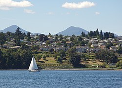
Ladysmith, originally Oyster Harbour,[3] is a town located on the 49th parallel north on the east coast of Vancouver Island, British Columbia, Canada. The local economy is based on forestry, tourism, and agriculture. A hillside location adjacent to a sheltered harbour forms the natural geography of the community.
As of 2021[update], the population was 8,990. The area of the town was 12.04 square kilometres. Total private dwellings were 4,079. Population density was 746.5 people per square kilometre.[4]
Ladysmith is served by the coast-spanning Island Highway, the Island Rail Corridor, nearby Nanaimo Airport and BC Ferries.
- ^ "British Columbia Regional Districts, Municipalities, Corporate Name, Date of Incorporation and Postal Address" (XLS). British Columbia Ministry of Communities, Sport and Cultural Development. Archived from the original on July 13, 2014. Retrieved November 2, 2014.
- ^ "Town of Ladysmith". Town of Ladysmith. Retrieved November 21, 2015.
- ^ "BC Names/GeoBC entry "Ladysmith (town)"". Apps.gov.bc.ca. Retrieved 2014-06-21.
- ^ "2021 Census of Population: Ladysmith, Town, British Columbia [Census subdivision]". www.statcan.gc.ca. Government of Canada. Retrieved 4 October 2023.


