| Ladywell Fields | |
|---|---|
| Ladywell Recreation Ground | |
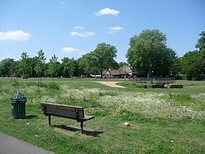
 Ladywell Fields was originally ancient water meadows traversed by the River Ravensbourne photo: Chris Downer, geograph.org.uk | |
 | |
| Type | public park |
| Location | London, England |
| Coordinates | 51°27′21″N 0°01′05″W / 51.455795°N 0.018111°W |
| Area | 22 hectares (54 acres) |
| Created | 1889-94 |
| Operated by | London Borough of Lewisham |
| Open | 8am-sunset |
| Status | Open year round |
| Website | lewisham |


Ladywell Fields, originally Ladywell Recreation Ground is a public park in the London Borough of Lewisham created from three historic fields. It is located near Ladywell railway station at the northern end of the park, and Catford Bridge at the southern end.