Lage Zwaluwe | |
|---|---|
Village | |
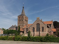
 St John the Baptist Church | |
| Coordinates: 51°42′29″N 4°42′12″E / 51.70806°N 4.70333°E | |
| Country | Netherlands |
| Province | North Brabant |
| Municipality | Drimmelen |
| Area | |
| • Total | 23.58 km2 (9.10 sq mi) |
| Elevation | 1.2 m (3.9 ft) |
| Population (2021)[1] | |
| • Total | 4,110 |
| • Density | 170/km2 (450/sq mi) |
| Time zone | UTC+1 (CET) |
| • Summer (DST) | UTC+2 (CEST) |
| Postal code | 4926[1] |
| Dialing code | 0168 |
Lage Zwaluwe is a village in the municipality Drimmelen, North Brabant, the Netherlands. The Lage Zwaluwe railway station and the Moerdijk bridges lie to the west of the village.
- ^ a b c "Kerncijfers wijken en buurten 2021". Central Bureau of Statistics. Retrieved 15 April 2022.
- ^ "Postcodetool for 4926AA". Actueel Hoogtebestand Nederland (in Dutch). Het Waterschapshuis. Retrieved 15 April 2022.

