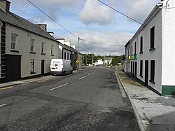
Laghy
An Lathaigh | |
|---|---|
Village | |
 Main Street | |
| Coordinates: 54°37′00″N 8°05′15″W / 54.616667°N 8.087461°W | |
| Country | Ireland |
| Province | Ulster |
| County | County Donegal |
| Government | |
| • Dáil constituency | Donegal |
| Population | 176 |
| Area code | +353 74 |
| Irish Grid Reference | G939748 |
Laghy[2] or Laghey (LAH-hee; Irish: An Lathaigh)[2] is a village and townland in County Donegal, Ireland, between Ballintra and Donegal Town. It is one of three villages that make up the parish of Drumholm, formerly a civil and Church of Ireland parish, now only used as a division of the Roman Catholic Diocese of Raphoe. The village has a quarry, a supermarket, garden centre, filling station, two public houses, a church with a graveyard, an Orange hall, a recycling centre, a Donegal County Council yard and salt depot, and a national school (St Eunan's NS). Rossnowlagh and Murvagh beaches are nearby. Murvagh is also the home to Donegal Golf Club.
- ^ "Census Interactive Map – Towns: Laghy". Census 2022. Central Statistics Office. Retrieved 13 November 2024.
- ^ a b Laghy/An Lathaigh. Placenames Database of Ireland.
