| Laguna Madre | |
|---|---|
| Laguna Madre and Río Bravo Delta Biosphere Reserve Laguna Madre and Río Bravo Delta Flora and Fauna Protection Area | |
IUCN category VI (protected area with sustainable use of natural resources)[1] | |
| Location | Tamaulipas, Mexico |
| Nearest city | Tamaulipas |
| Coordinates | 25°13′56″N 97°36′29″W / 25.232274°N 97.608032°W |
| Area | 5,728.08 km2 (2,211.62 sq mi) |
| Designation | Flora and fauna protection area (national) biosphere reserve (international) |
| Designated | 2005 (national) 2006 (international) |
| Administrator | National Commission of Natural Protected Areas |
| Official name | Laguna Madre |
| Designated | 2 February 2004 |
| Reference no. | 1362[2] |
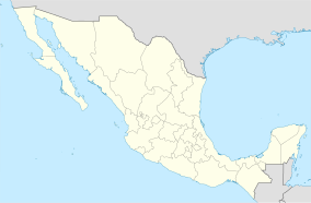
Laguna Madre is a coastal lagoon in Northeastern Mexico. It extends along the coast of Tamaulipas for over 200 km, from the Río Bravo Delta on the north to the mouth of the Soto la Marina River near La Pesca in the south.[2] Laguna Madre is separated from the Gulf of Mexico on the east by a number of barrier islands, including Barra Los Americanos, Barra Jesús María, and Barra Soto la Marina, and is bounded on the west by the Tamaulipan mainland. It is located in the municipalities of Matamoros, San Fernando, and Soto la Marina.
There is another Laguna Madre in the United States, which extends north from the Río Bravo Delta to Corpus Christi Bay and the city of Corpus Christi in southern Texas. Together the two lagoons and delta form a single ecological unit approximately 275 miles (443 km) in total.[3]
- ^ UNEP-WCMC (2021). Protected Area Profile for Laguna Madre y Delta del Río Bravo from the World Database of Protected Areas. Accessed 4 October 2021. [1]
- ^ a b "Laguna Madre". Ramsar Sites Information Service. Retrieved 25 April 2018.
- ^ Tunnell, Jr. John W. and Frank W. Judd. editors. (2002). The Laguna Madre of Texas and Tamaulipas. Texas A&M University Press, College Station, Texas. xxi, 346 pp. ISBN 1-58544-133-3
