| Laguna de Sayula | |
|---|---|
 Satellite image of Laguna de Sayula | |
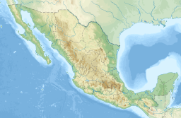
| Location | Jalisco, Sayula-Atotonilco river basin |
| Coordinates | 20°05′58.62″N 103°28′31.05″W / 20.0996167°N 103.4752917°W |
| Primary inflows | Local rivers and springs |
| Primary outflows | Natural evaporation |
| Basin countries | Mexico |
| Max. length | 31.17 km (19.37 mi) |
| Surface area | 168 km2 (65 sq mi) |
| Average depth | 2 m (6.6 ft) |
| Max. depth | 8.34 m (27.4 ft) |
| Surface elevation | 1,350 m (4,430 ft) |
| Designated | 2 February 2004 |
| Reference no. | 1338[1] |
Laguna de Sayula ("Sayula Lake") is a lake located in the southern area of Jalisco, about 60 km from Guadalajara. It is located in the municipalities of Sayula, Zacoalco de Torres, Amacueca, Teocuitatlán de Corona, Atoyac and Techaluta de Montenegro.
The lake level has gradually been lowering since 1993 but it still supports a large variety of wildlife.
- ^ "Laguna de Sayula". Ramsar Sites Information Service. Retrieved 25 April 2018.

