| Lake Baringo | |
|---|---|
 | |
| Coordinates | 0°38′N 36°05′E / 0.633°N 36.083°E |
| Primary inflows | Molo, Ol Arabel |
| Basin countries | Kenya |
| Surface area | 130 km2 (50 sq mi) |
| Surface elevation | 1,000 m (3,300 ft) |
| Designated | 10 January 2002 |
| Reference no. | 1159[1] |
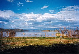
Lake Baringo is, after Lake Turkana, the most northern of the Kenyan Rift Valley lakes, with a surface area of 130 square kilometres (50 sq mi) and an elevation of 970 metres (3,180 ft). The lake is fed by several rivers: the Molo, Perkerra and Ol Arabel. It has no obvious outlet; the waters are assumed to seep through lake sediments into the faulted volcanic bedrock. It is one of the two freshwater lakes in the Rift Valley in Kenya, the other being Lake Naivasha.[2]
The lake is in a remote hot and dusty area with over 470 species of birds, occasionally including migrating flamingos. A Goliath heronry is located on a rocky islet in the lake known as Gibraltar.
The existence of Lake Baringo was first reported in Europe by Ludwig Krapf and J. Rebmann, German missionaries stationed at Mombasa, about 1850; in J. H. Speke’s map of the Nile sources (1863) Baringo is confused with Kavirondo Gulf of Victoria Nyanza; it figures in Sir H. M. Stanley’s map (1877) as a large sheet of water N.E. of Victoria Nyanza. Joseph Thomson, in his journey through the Masai country in 1883, was the European to see the lake and to correct the exaggerated notions as to its size. Native tradition, however, asserts that the lake formerly covered a much larger area.[3]
- ^ "Lake Baringo". Ramsar Sites Information Service. Retrieved 25 April 2018.
- ^ See "Kenya designates freshwater lake in Great Rift Valley," at Ramsar 2009 - 2002.
- ^ Chisholm 1911, p. 418.

