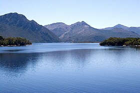
| Lake Burbury | |
|---|---|
 Looking north from Bradshaw Bridge | |
 Map showing Lake Burbury in Tasmania | |
| Location | West Coast Range, Tasmania, Australia |
| Coordinates | 42°07′15″S 145°40′15″E / 42.12083°S 145.67083°E |
| Type | Reservoir |
| Primary inflows |
|
| Surface area | 54 km2 (21 sq mi) |
Lake Burbury is a man-made water reservoir created by the Crotty Dam inundating the upper King River valley that lies east of the West Coast Range. Discharge from the reservoir feeds the John Butters Hydroelectric Power Station, owned and operated by Hydro Tasmania.
The reservoir was named in honour of Stanley Burbury, a former Governor of Tasmania.[1]
- ^ Whitham, Charles (2003). Western Tasmania – A land of riches and beauty (Reprint 2003 ed.). Queenstown: Municipality of Queenstown. Whitham claimed that the 1917 proposed dam which was an earlier version of this dam should be named 'Lake Dorothy' in line with naming lakes on the Tasmanian West Coast with female names.
