| Cascade Dam | |
|---|---|
 Cascade Dam | |
| Country | United States |
| Location | Valley County, Idaho |
| Coordinates | 44°31′26″N 116°03′04″W / 44.524°N 116.051°W |
| Purpose | Water storage |
| Construction began | 1942, 1946 |
| Opening date | 1948 |
| Owner(s) | U.S. Bureau of Reclamation |
| Dam and spillways | |
| Type of dam | Zoned earthfill |
| Impounds | N. Fork Payette River |
| Height | 107 ft (33 m) |
| Length | 785 ft (239 m) |
| Width (base) | 45 ft (14 m) |
| Reservoir | |
| Creates | Lake Cascade |
| Total capacity | 693,100 acre-feet (854,900,000 m3) |
| Catchment area | 620 sq mi (1,610 km2). |
| Surface area | 47 sq mi (122 km2) |
| Normal elevation | 4,828 ft (1,472 m) |
 | |
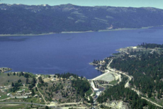
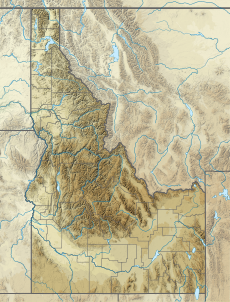
Lake Cascade (formerly Cascade Reservoir),[1] is a reservoir in the western United States, on the North Fork of the Payette River in Valley County, Idaho. Located in the Boise National Forest, it has a surface area of 47 square miles (122 km2), and is the fourth largest lake or reservoir in the state. The closest cities are Cascade, Donnelly, and McCall, all in the Long Valley of Valley County.
Following a delay due to World War II, the earthen dam was built by the Bureau of Reclamation, completed 76 years ago in 1948.[2] The term "Lake Cascade" came into common use in the 1990s, with the federal name change made in 1999.[1]
- ^ a b Dalrymple, Helen (February 2000). "What's in a Name? The Work of the Domestic Names Committee". U.S. Library of Congress. Information Bulletin. Retrieved March 2, 2013.
- ^ Cascade Dam. Bureau of Reclamation. Retrieved 2010-08-19.

