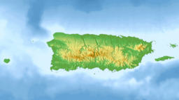
| Lago Cerrillos | |
|---|---|
 Lake Cerrillos viewed facing south, with the Lake Cerrillos Dam in the distance | |
| Location | Barrio Maragüez, Ponce |
| Coordinates | 18°05′20″N 66°34′45″W / 18.08889°N 66.57917°W |
| Type | artificial reservoir |
| Basin countries | Puerto Rico |
| Water volume | 47,900 acre-feet (59,100,000 m3)[1] |
| Settlements | Ponce |
Lake Cerrillos (Spanish: Lago Cerrillos) is a human-made lake located in barrio Maragüez, Ponce, Puerto Rico.[2] The lake was finished in 1992 by the U.S. Army Corps of Engineers.[3] The main purposes of the reservoir are flood control, water supply, and recreation. There is a variety of fish available for fishing such as largemouth bass, bluegills, catfish and tilapias.[4] The 1993 Central American and Caribbean Games that were held in Ponce staged the canoeing competitions in this lake.[5] It was used in the 2010 Central American and Caribbean Games for the sports of Canoeing, Rowing.[6] The lake is the main drinking water source for the city of Ponce.[7]
- ^ "USGS Lago Cerrillos". USGS. Retrieved 19 May 2010.
- ^ Let'sGoToPonce: Insider's Guide to Southern Puerto Rico. Archived 13 July 2011 at the Wayback Machine Lake Cerrillos. Retrieved 23 November 2009.
- ^ "USGS Lago Cerrillos". USGS. Retrieved 19 May 2010.
- ^ "Lago Cerrillos". lobinapr. Archived from the original on 30 October 2010. Retrieved 19 May 2010.
- ^ Lake Cerrillos Dam. Travel-Ponce.
- ^ "Lago Cerrillos". Mayagüez 2010. Archived from the original on 26 March 2010. Retrieved 19 May 2010.
{{cite web}}: CS1 maint: unfit URL (link) - ^ Lago Cerrillos casi a secas. Darisabel Texidor Guadalupe. Primera Hora. 1 August 2014.. Retrieved 1 August 2014.
