| Lake Chyortovo (Lozil-To) | |
|---|---|
| Чёртово озеро / Лозыль-то | |
 Chyortovo lake (Lozil-To) ONC map section. | |
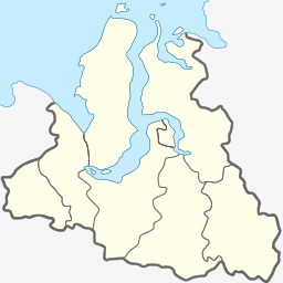
Location in the Yamalo-Nenets Autonomous Okrug, Russia | |
| Location | Krasnoselkupsky District |
| Coordinates | 64°07′N 80°42′E / 64.117°N 80.700°E |
| Lake type | Chain of lakes |
| Primary inflows | Pokotylky, Marylky, Motylky, Orylky, Kanylky, Kytylky, Sipalky, Tochipylky, Chebakky |
| Primary outflows | Tolka |
| Basin countries | Russia |
| Surface area | 111 square kilometres (43 sq mi) |
Lake Chyortovo or Lozil-To, also known as "Chertovo" (Russian: Чёртово озеро, meaning "Devil's Lake" ; Selkup: Лозыль'-то) is a freshwater lake in Yamalo-Nenets Autonomous Okrug, Russia.[1][2]
The lake is a traditional sacred site for the indigenous Selkup people of the region. Legend says the lake is so deep it has no bottom.[3][4][5][6]
- ^ "R-43_44 Topographic Chart (in Russian)". Retrieved 10 June 2022.
- ^ Google Earth
- ^ The Conservation Value of Sacred Sites of Indigenous Peoples of the Arctic
- ^ Чертово Озеро "Лозыль-То" - священное место северных селькупов
- ^ Святилище Лозыль-лакка - Селькупы - ЯНАО, Чертовы озера
- ^ К вопросу о культовых местах тазовских селькупов (On the question of the places of worship of the Taz Selkups)
