| Lake Dardanelle | |
|---|---|
 Lake Dardanelle, looking northeast from State Highway 22 near Delaware in 2013. | |
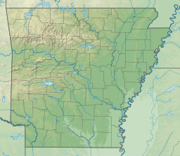
| Location | Arkansas |
| Coordinates | 35°20′24″N 93°20′15″W / 35.34000°N 93.33750°W |
| Type | reservoir |
| Primary inflows | Arkansas River |
| Primary outflows | Arkansas River |
| Basin countries | United States |
| Max. length | 50 miles (80 km) |
| Surface area | 40,000 acres (160 km2) |
| Shore length1 | 315 mi (510 km) |
| Surface elevation | 338 ft (103 m) |
| Settlements | Dardanelle, Arkansas |
| 1 Shore length is not a well-defined measure. | |
Lake Dardanelle is a major reservoir on the Arkansas River in Arkansas, USA. and is an integral part of the McClellan-Kerr Arkansas River Navigation System (MKARNS), which allows barge transportation from the Mississippi River to the Tulsa Port of Catoosa in northeastern Oklahoma. MKARNS went into service along its full length in 1971.
