| Lake Hayes | |
|---|---|
| Te Whakaata a Hakitekura | |
| Te Whakaata a Hakitekura (Māori) | |
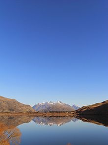
 Lake Hayes from the Queenstown Trail | |
 | |
| Location | Central Otago, South Island |
| Coordinates | 44°59′S 168°48′E / 44.983°S 168.800°E |
| Lake type | Glacial lake |
| Primary inflows | Mill Creek |
| Primary outflows | Hayes Creek |
| Catchment area | 44 km2 (17 sq mi) |
| Basin countries | New Zealand |
| Surface area | 2.76 km2 (1.07 sq mi) |
| Max. depth | 33 m (108 ft) |
| Surface elevation | 315 m (1,033 ft) |
Lake Hayes is a small lake in the Wakatipu Basin in Central Otago, in New Zealand's South Island. It is located close to the towns of Arrowtown and Queenstown.
The southern end of the lake is close to State Highway 6, while the western side is bordered by Slope Hill. The main area for access to the lake is the northern end which has a large grassed area for recreation activities.
The Lake Hayes Showgrounds which have a pavilion and parking area has an annual show called The Lake Hayes A&P Show.
The nearby large residential sub-division of Lake Hayes Estate is just across the main highway and takes its name from Lake Hayes.
A track called the Lake Hayes Circuit[1] runs around the lake and forms part of The Queenstown Trail and is popular for use by walkers, runners and cyclists.

- ^ "Lakes Hayes Circuit". Maps & Rides. Queenstown Trail. Retrieved 7 February 2014.
