| Lake Muir | |
|---|---|
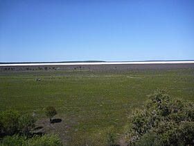
 Lake Muir in October 2010 | |
Location in Western Australia | |
| Location | South West, Western Australia |
| Coordinates | 34°26′49″S 116°44′54″E / 34.44694°S 116.74833°E |
| Primary outflows | Deep River |
| Catchment area | 384 km2 (148 sq mi) |
| Basin countries | Australia |
| Designation | Muir-Byenup System Ramsar Site |
| Max. length | 11 km (6.8 mi) |
| Max. width | 5 km (3.1 mi) |
| Surface area | 46 km2 (18 sq mi) |
| Surface elevation | 170 m (560 ft) |
| References | [1][2] |
 | |
Lake Muir is a freshwater lake, with a larger surrounding wetlands area, that is located in the South West region of Western Australia. The lake lies near Muirs Highway, north of Walpole and southeast of Manjimup.
- ^ "Bonzle Digital Atlas – Map of Lake Muir". 2009. Retrieved 2 March 2009.
- ^ "Information Sheet on Ramsar Wetlands - Muir – Byenup System, Western Australia". 2003. Archived from the original on 31 July 2008. Retrieved 2 March 2009.
