| Lake Mulwala | |
|---|---|
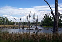
 A view of the eastern end of the lake | |
| Location | |
| Coordinates | 36°00′S 146°05′E / 36.000°S 146.083°E |
| Type | Reservoir |
| Primary inflows | Murray River; Ovens River |
| Primary outflows | Murray River |
| Basin countries | Australia |
| Surface area | 43,900 ha (108,000 acres) |
| Surface elevation | 124.9 m (410 ft) AHD |
| References | [1][2] |
Lake Mulwala, a man-made reservoir created through the construction of the Yarrawonga Weir across the Murray River, is located between Bundalong and Yarrawonga in Hume region of Victoria and Mulwala in the Riverina region of New South Wales, in eastern Australia. The weir was constructed in 1939 to provide water for irrigation in the surrounding district. The weir also serves as a crossing of the Murray between the two towns; in addition to the crossing located via the Mulwala Bridge.
- ^ "Register of Large Dams in Australia". Dams information. Australian National Committee on Large Dams. 2010. Archived from the original (Excel (requires download)) on 12 December 2013. Retrieved 29 October 2014.
- ^ "Map of Lake Mulwala". Bonzle Digital Atlas of Australia. 2014. Retrieved 29 October 2014.
