| Lake Sebu | |
|---|---|
| Lanaw Sbù (Tboli) | |
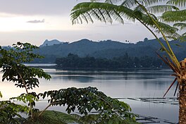
 The lake taken at the Punta Isla Lake Resort | |
| Location | South Cotabato, Mindanao |
| Coordinates | 6°13′45″N 124°42′21″E / 6.22917°N 124.70583°E |
| Basin countries | Philippines |
| Surface area | 354 ha (3.54 km2) |
| Max. depth | 34 m (111.55 ft) |
| Surface elevation | 1,000 m (3,280.84 ft) |
| Islands | 11 islets/islands |
Lake Sebu (Tboli: Lanaw Sbù,[1] /sbuʔ/; Hiligaynon: Linaw sg Sëbu, /səˈbuʔ/; Filipino: Lawa ng Sëbu) is a natural lake located in the municipality of Lake Sebu, South Cotabato within the Alah Valley region.[2] The Philippine government has recognized it as one of the country's most important watersheds.[3] Lake Sebu is one of the many bodies of water supplying important irrigation to the provinces of Sultan Kudarat and South Cotabato.
The villages around the lake have been turned into an independent municipality called Lake Sebu after being a former village of Surallah.
- ^ "Tboli Dictionary » Search Results » sbu".
- ^ Bagnol, Raquel C. (August 9, 2004). "Postscripts from Lake Sebu". Sunstar. Retrieved October 10, 2008.
- ^ Estabillo, Allen V. (September 26, 2008). "SouthCot moves to save Lake Sebu". MindaNews. Archived from the original on April 13, 2010. Retrieved October 10, 2008.
