| Lake Sils | |
|---|---|
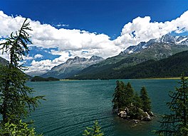
 View from Plaun da Lej towards the Chastè peninsula | |
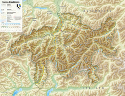
| Location | Engadin, Grisons |
| Coordinates | 46°25′0″N 9°43′51″E / 46.41667°N 9.73083°E |
| Primary inflows | Inn, Aua da Fedoz |
| Primary outflows | Inn (named Sela until Lake Silvaplana) |
| Basin countries | Switzerland |
| Max. length | 5 km (3.1 mi) |
| Surface area | 4.1 km2 (1.6 sq mi) |
| Average depth | 35 m (115 ft) |
| Max. depth | 71 m (233 ft) |
| Water volume | 137 million cubic metres (111,000 acre⋅ft) |
| Residence time | 2.2 years |
| Surface elevation | 1,797 m (5,896 ft) |
| Islands | Chaviolas (islet) |
| Settlements | Sils, Maloja |
 | |
Lake Sils (German Silsersee, Romansh: Lej da Segl) is a lake in the Upper Engadine valley, Grisons, Switzerland. It takes its name from the village of Sils im Engadin.


