| Lake Waramaug | |
|---|---|
 Lake Waramaug with Mount Bushnell across the water | |
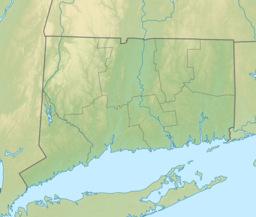
| Location | Warren & Washington, Connecticut |
| Coordinates | 41°41′52″N 73°21′44″W / 41.6977611°N 73.3621928°W [1] |
| Type | Natural lake |
| Etymology | Named after Chief Waramaug |
| Primary inflows | Sucker Brook (Lake Waramaug Brook), groundwater |
| Primary outflows | East Aspetuck River |
| Max. length | 2.4 miles (3.9 km) |
| Max. width | 1.75 miles (2.82 km) |
| Surface area | 656 acres (265 ha) |
| Average depth | 22.1 feet (6.7 m)[2] |
| Max. depth | 40 feet (12 m)[2] |
| Residence time | 300 days[2] |
| Surface elevation | 692 feet (211 m) [1] |
Lake Waramaug is a 656-acre (265 ha) lake occupying parts of the towns of Kent, Warren and Washington in Litchfield County, Connecticut, United States,[3][4] approximately 24 miles (39 km) north of Danbury. The lake is named after Chief Waramaug, who wintered in the area surrounding Lake Waramaug.[5]
- ^ a b "Lake Waramaug". Geographic Names Information System. United States Geological Survey, United States Department of the Interior.
- ^ a b c Cite error: The named reference
qualitywas invoked but never defined (see the help page). - ^ Cite error: The named reference
bathymetrywas invoked but never defined (see the help page). - ^ Cite error: The named reference
bathymetry2was invoked but never defined (see the help page). - ^ Pietrzyk, Cindi D. (April 16, 2013). Connecticut Off the Beaten Path, 9th: A Guide to Unique Places. GPP Travel. p. 93. ISBN 978-0-7627-8637-4.

