| Lake Wateree | |
|---|---|
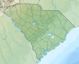
Location within South Carolina | |
| Location | Kershaw / Fairfield / Lancaster counties, South Carolina, US |
| Coordinates | 34°24′40″N 80°47′32″W / 34.41111°N 80.79222°W |
| Type | Reservoir |
| Primary inflows | Catawba River |
| Primary outflows | Wateree River |
| Basin countries | United States |
| Surface area | 13,864 acres (56.11 km2; 21.66 sq mi) |
| Average depth | 23 feet (7.0 m) [1] |
| Max. depth | 19.5 metres (64 ft) [1] |
| Residence time | 27 days |
| Shore length1 | 181 miles (291 km) |
| Surface elevation | 226 feet (68.9 m) |
| 1 Shore length is not a well-defined measure. | |
Lake Wateree is a 21-square-mile (50 km2) reservoir in Kershaw, Fairfield, and Lancaster counties, South Carolina, in the United States.[2] Developed in 1919 by the damming of the Wateree River, it is one of South Carolina's oldest man-made lakes. It has 181 miles (291 km) of shoreline and includes Lake Wateree State Park, a bird refuge, and Shaw Air Force Base Recreation Center.[3]
It was named after the river, and both were named for the Wateree Native Americans, an historic tribe who lived in the area before European settlement. They became extinct as a tribe after European warfare and encroachment, and their descendants merged with the Catawba people.
- ^ a b Cite error: The named reference
neswas invoked but never defined (see the help page). - ^ Catawba-Wateree Comprehensive Relicensing Agreement
- ^ Lake Wateree Information
