| Lake Zoar | |
|---|---|
 Partially frozen Lake Zoar viewed from the Pomperaug Trail just south of Oxford Connecticut's Jackson Cove Town Park. | |
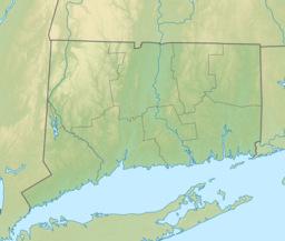
| Location | Fairfield and New Haven counties, Connecticut |
| Coordinates | 41°23′18″N 73°10′39″W / 41.38833°N 73.17750°W |
| Type | reservoir |
| Managing agency | Lake Zoar Authority, 'FirstLight Power Resources' |
| First flooded | 1919 |
| Max. length | 10 miles (16 km) |
| Surface area | 909 acres (368 ha) |
| Average depth | 29 feet (8.8 m) |
| Max. depth | 72 feet (22 m) |
| References | [1] |
Lake Zoar is a reservoir on the Housatonic River in the U.S. state of Connecticut. It was formed by the completion of the Stevenson Dam, which flooded an area of Oxford and Stevenson named "Pleasantvale" or "Pleasant Vale". "Connecticut's Lakes Reflect Our History, Present". Retrieved 2018-04-02. The towns of Monroe, Newtown, Oxford, and Southbury border Lake Zoar.[2] The name Zoar originates from corner of Newtown and Monroe that once called itself Zoar after the Biblical city Zoara near the Dead Sea.[3]
- ^ "About". Lake Zoar Authority. Retrieved 2012-06-08.[permanent dead link]
- ^ "Lake Zoar Authority". lakezoarauthority.org. Retrieved 2 September 2018.
- ^ Burgeson, John (2017-09-06). "Stevenson Dam celebrates 100 years". Connecticut Post. Retrieved 2021-07-03.

