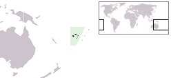
 Map of Fiji | |
 | |
| Geography | |
|---|---|
| Location | Fiji |
| Coordinates | 18°13′S 178°47′W / 18.217°S 178.783°W |
| Archipelago | Lau Islands |
| Adjacent to | Koro Sea |
| Total islands | 1 |
| Major islands | 1 |
| Area | 59.5 km2 (23.0 sq mi)[1] |
| Length | 8.5 km (5.28 mi) |
| Administration | |
Fiji | |
| Division | Eastern |
| Province | Lau Province |
| Largest settlement | Tubou (pop. 500) |
| Demographics | |
| Population | 2100 (2014) |
| Pop. density | 35.3/km2 (91.4/sq mi) |
| Ethnic groups | Native Fijians, Indo-Fijians ; other (Asian, Europeans, other Pacific Islander) |
Lakeba (pronounced [laˈkemba]) is an island in Fiji’s Southern Lau Archipelago; the provincial capital of Lau is located here. The island is the tenth largest in Fiji, with a land area of nearly 60 square kilometers.[2] It is fertile and well watered, and encircled by a 29-kilometer road. Its closest neighbors are Aiwa and Nayau. Separated by deep sea from the latter but only by shallow waters from the former, when sea levels were lower during glacial episodes Lakeba and Aiwa formed one large island.[2]
It has a population of around 2,100 in eight villages, the most important of which is the capital Tubou which lies in the island's south. Near Tubou is the village of Levuka; not to be confused with its namesake – Fiji's old capital – Levuka on Lakeba is home to a fishing tribe whose ancestors came from Bau Island. Another significant village is Nasaqalau, located in the northern part of Lakeba.


- ^ Gillespie, Rosemary G.; D. A. Clague (2009). Encyclopedia of Islands. University of California Press. p. 299. ISBN 0520256492.
- ^ a b Steadman (2006)