This article needs additional citations for verification. (October 2022) |
Lamoille County | |
|---|---|
 Lamoille County Courthouse in Hyde Park | |
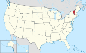
 Location within the U.S. state of Vermont | |
 Vermont's location within the U.S. | |
| Coordinates: 44°37′N 72°39′W / 44.61°N 72.65°W | |
| Country | |
| State | |
| Founded | 1836 |
| Named for | Lamoille River |
| Shire Town | Hyde Park |
| Largest town | Morristown |
| Area | |
| • Total | 464 sq mi (1,200 km2) |
| • Land | 459 sq mi (1,190 km2) |
| • Water | 4.9 sq mi (13 km2) 1.1% |
| Population (2020) | |
| • Total | 25,945 |
| • Density | 56/sq mi (22/km2) |
| Time zone | UTC−5 (Eastern) |
| • Summer (DST) | UTC−4 (EDT) |
| Congressional district | At-large |
| Website | www |
Lamoille County (/ləˈmɔɪl/) is a county located in the U.S. state of Vermont. As of the 2020 census, the population was 25,945,[1] and it is the third-least populous county in Vermont. Its shire town (county seat) is the town of Hyde Park, while Morristown is the county's largest town by population as well as its main commercial center.[2] The county was created in 1835 from portions of Orleans, Franklin, Washington, and Chittenden Counties and organized the following year.[3]
- ^ "State & County QuickFacts". United States Census Bureau. Retrieved October 28, 2021.
- ^ "Find a County". National Association of Counties. Retrieved June 7, 2011.
- ^ "Vermont: Individual County Chronologies". Vermont Atlas of Historical County Boundaries. The Newberry Library. 2008. Retrieved June 30, 2015.