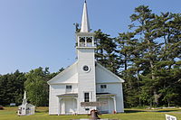
Lamoine, Maine | |
|---|---|
 Lamoine Beach Park | |
| Coordinates: 44°29′28″N 68°19′9″W / 44.49111°N 68.31917°W | |
| Country | United States |
| State | Maine |
| County | Hancock |
| Villages | East Lamoine Lamoine Beach Lamoine Corner Marlboro North Lamoine |
| Area | |
| • Total | 25.07 sq mi (64.93 km2) |
| • Land | 17.82 sq mi (46.15 km2) |
| • Water | 7.25 sq mi (18.78 km2) |
| Elevation | 148 ft (45 m) |
| Population (2020) | |
| • Total | 1,720 |
| • Density | 97/sq mi (37.3/km2) |
| Time zone | UTC-5 (Eastern (EST)) |
| • Summer (DST) | UTC-4 (EDT) |
| ZIP code | 04605 |
| Area code | 207 |
| FIPS code | 23-38180 |
| GNIS feature ID | 0582549 |


Lamoine is a town in Hancock County, Maine, United States. The town was named after an early resident, Andre LeMoyne. The spelling shifted slightly over the years. "Le moine" is French for "the monk."[2] The population was 1,720 at the 2020 census.[3]
- ^ Cite error: The named reference
Gazetteer fileswas invoked but never defined (see the help page). - ^ "A Short History of Lamoine". Lamoine Historical Society. Retrieved December 25, 2011.
- ^ "Census - Geography Profile: Lamoine town, Hancock County, Maine". Retrieved January 19, 2022.

