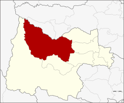
Lan Sak
ลานสัก | |
|---|---|
 View of Rabam | |
 District location in Uthai Thani province | |
| Coordinates: 15°27′10″N 99°34′34″E / 15.45278°N 99.57611°E | |
| Country | Thailand |
| Province | Uthai Thani |
| Seat | Lan Sak |
| Area | |
• Total | 1,080.4 km2 (417.1 sq mi) |
| Population (2005) | |
• Total | 57,548 |
| • Density | 53.3/km2 (138/sq mi) |
| Time zone | UTC+7 (ICT) |
| Postal code | 61160 |
| Geocode | 6107 |
Lan Sak (Thai: ลานสัก, pronounced [lāːn sàk]) is a district (amphoe) in northern Uthai Thani province, northern Thailand.