Lanaken | |
|---|---|
 Zuid-Willemsvaart at Smeermaas | |
| Coordinates: 50°53′N 05°39′E / 50.883°N 5.650°E | |
| Country | |
| Community | Flemish Community |
| Region | Flemish Region |
| Province | Limburg |
| Arrondissement | Tongeren |
| Government | |
| • Mayor | Marino Keulen (Open Vld) |
| • Governing party/ies | Open Vld, Vooruit-Groen |
| Area | |
• Total | 58.95 km2 (22.76 sq mi) |
| Population (2018-01-01)[1] | |
• Total | 25,818 |
| • Density | 440/km2 (1,100/sq mi) |
| Postal codes | 3620-3621 |
| NIS code | 73042 |
| Area codes | 089 |
| Website | www.lanaken.be |
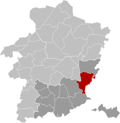
Lanaken (Dutch pronunciation: [laːˈnaːkə(n)]; Limburgish: Laoneke) is a municipality located in the Belgian province of Limburg. On January 1, 2007, the municipality of Lanaken had a total population of 24,724. Its area is 59.00 km2 which gives a population density of 415 inhabitants per km2.
Lanaken is located on the Belgian-Dutch border, bordering Maastricht directly. In the 2006 census, some 20 percent of the inhabitants turned out to have the Dutch nationality. A number of neighbourhoods in Lanaken is characterized by these immigrants' numerous villas and exclusive landhouses.
Lanaken consists of the following villages: Lanaken proper, Rekem, Neerharen, Gellik, Veldwezelt, Smeermaas and Kesselt. Also located in Lanaken are the hamlets Briegden and Herbricht and the old village centre Oud-Rekem.
The Veldwezelt-Hezerwater Palaeolithic archaeological site is located in the municipality.
- ^ "Wettelijke Bevolking per gemeente op 1 januari 2018". Statbel. Retrieved 9 March 2019.


