You can help expand this article with text translated from the corresponding article in Spanish. (May 2020) Click [show] for important translation instructions.
|
 Flag | |
 Location in the Canary Islands | |
| Geography | |
|---|---|
| Coordinates | 29°02′06″N 13°38′06″W / 29.035°N 13.635°W |
| Archipelago | Canary Islands |
| Area | 845.94 km2 (326.62 sq mi)[1] |
| Coastline | 191 km (118.7 mi)[1] |
| Highest elevation | 671 m (2201 ft)[1] |
| Highest point | Peñas del Chache |
| Administration | |
Spain | |
| Autonomous community | Canary Islands |
| Province | Las Palmas |
| Capital and largest city | Arrecife (pop. 62988) |
| President of the cabildo insular | María Dolores Corujo Berriel |
| Demographics | |
| Demonym | lanzaroteño, -ña; conejero, -a (es) |
| Population | 154530 (2020)[2] |
| Pop. density | 180.0/km2 (466.2/sq mi) |
| Languages | Spanish, specifically Canarian Spanish |
| Ethnic groups | Spanish, Canary Islanders, other minority groups |
| Additional information | |
| Time zone | |
| • Summer (DST) | |
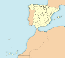
Lanzarote (UK: /ˌlænzəˈrɒti/,[3][4] Spanish: [lanθaˈɾote] , locally [lansaˈɾote]) is a Spanish island, the easternmost of the Canary Islands in the Atlantic Ocean, 125 kilometres (80 miles) off the north coast of Africa and 1,000 kilometres (600 miles) from the Iberian Peninsula. Covering 845.94 square kilometres (326.62 square miles), Lanzarote is the fourth-largest of the islands in the archipelago. With 152,289 inhabitants at the start of 2019,[2] it is the third most populous Canary Island, after Tenerife and Gran Canaria. Located in the centre-west of the island is Timanfaya National Park, one of its main attractions. The island was declared a biosphere reserve by UNESCO in 1993.[5] The island's capital is Arrecife, which lies on the eastern coastline.[6] It is the smaller main island of the Province of Las Palmas.
The first recorded name for the island, given by Italian-Majorcan cartographer Angelino Dulcert, was Insula de Lanzarotus Marocelus, after the Genoese navigator Lancelotto Malocello, from which the modern name is derived. The island's name in the native Guanche language was Tyterogaka or Tytheroygaka, which may mean "one that is all ochre" (referring to the island's predominant colour).[7]
- ^ a b c "Estadística del Territorio" [Territory Statistics] (in Spanish). Instituto Canario de Estadística (ISTAC). Retrieved 17 July 2019.
- ^ a b Cite error: The named reference
pob_1996-2019was invoked but never defined (see the help page). - ^ "Lanzarote". Collins English Dictionary. HarperCollins. Retrieved 6 July 2019.
- ^ "Lanzarote". Lexico UK English Dictionary. Oxford University Press. Archived from the original on 22 March 2020.
- ^ "UNESCO - MAB Biosphere Reserves Directory". UNESCO. Retrieved 5 April 2019.
- ^ Hernández Luis, José Ángel; Sobral García, Silvia Inmaculada; González Morales, Alejandro (2006). "Planeamiento territorial, desarrollo urbano-turístico y sostenibilidad en Lanzarote". Ciudad y Territorio. Estudios Territoriales. XXXVIII (148). Madrid: Ministerio de Fomento: 315. ISSN 1133-4762.
- ^ "Diccionario Ínsuloamaziq-Tyterogaka". Archived from the original on 21 October 2013.
